7 Best Maps for Discovering Hidden Lake Coves Locals Keep Secret
Discover pristine solitude with our guide to the 7 best mapping tools for finding hidden lake coves, featuring expert tips for navigation and exploration of secluded waterways.
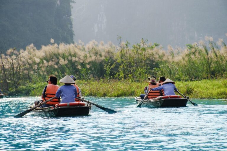
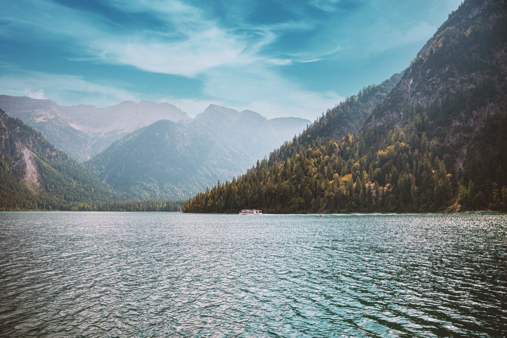
Looking for secluded spots where crystal-clear waters meet untouched shorelines? Hidden lake coves offer peaceful retreats away from crowded beaches and noisy marinas, but finding these natural treasures requires the right navigational tools.
Whether you’re planning a kayaking adventure, a quiet fishing expedition, or simply seeking solitude, having access to specialized maps can transform your lake experience from ordinary to extraordinary. We’ve researched and compiled the seven most effective mapping resources that reveal these concealed aquatic gems.
Disclosure: As an Amazon Associate, this site earns from qualifying purchases. Thank you!
Understanding The Value Of Specialized Maps For Lake Exploration
Standard maps often fall short when you’re seeking those hidden lake treasures. Specialized lake maps reveal underwater topography, shoreline details, and access points that regular maps simply don’t show. They’re specifically designed to highlight coves, inlets, and secluded areas that remain invisible on general-purpose maps.
Beyond just showing water and land, quality lake exploration maps include depth contours, submerged structure information, and often note seasonal water level changes that affect accessibility. These details prove invaluable when you’re planning to discover sheltered coves with your kayak, fishing boat, or paddleboard.
The difference between a frustrating day of aimless searching and discovering a perfect hidden sanctuary often comes down to having the right map in your hands. Specialized maps save you time, fuel, and significantly enhance your safety on unfamiliar waters by identifying hazards like submerged rocks or shallow areas that could damage your watercraft.
The Top 7 Maps For Finding Hidden Lake Coves
Armed with the right maps, you’ll unlock access to secluded coves that most lake visitors never discover. Here are the seven best mapping resources to guide your exploration.
Navionics Electronic Boating Charts
Navionics charts offer unparalleled detail for boaters seeking hidden coves with precise depth contours and navigational aids. These electronic maps highlight underwater structures and provide real-time updates as you navigate, making them essential for safely exploring secluded shorelines that don’t appear on standard maps.
Fishing Hot Spots Pro USA Lake Maps
Fishing Hot Spots maps reveal prime cove locations that anglers typically keep secret. These specialized maps identify critical structural features like drop-offs, weed beds, and submerged points—all indicators of potential hidden coves. You’ll discover detailed information about water depth transitions that often lead to secluded shoreline pockets.
Humminbird LakeMaster Digital GPS Maps
Humminbird’s high-resolution GPS maps display underwater topography with exceptional clarity, revealing hidden coves that remain invisible from the water’s surface. These maps offer customizable depth highlighting to identify shallow entry points into secluded areas. You’ll navigate with confidence using their detailed shoreline renderings that show even the smallest inlets.
National Geographic TOPO! Explorer Maps
National Geographic’s topographic maps excel at revealing hidden coves accessible by land or water. Their detailed elevation data helps identify steep shorelines where secluded coves often form. You’ll discover potential hiking routes to water-access-only coves and gain comprehensive geographical context that electronic boating maps might miss.
US Army Corps Of Engineers Lake Survey Maps
The Army Corps’ meticulously surveyed maps provide authoritative data on lake structures, including rarely visited coves. These maps document precise water levels, depth contours, and structural features based on comprehensive lake surveys. You’ll benefit from their exceptional accuracy in identifying secluded areas around flood control and recreational lakes.
Google Earth Pro With Historical Imagery
Google Earth Pro reveals hidden coves through both current and historical satellite imagery. You’ll spot seasonal water level changes that expose otherwise hidden coves and track shoreline developments over time. The 3D visualization allows you to virtually scout promising coves before your actual visit.
Crowdsourced Fishing Apps With GPS Marking
Apps like Fishidy and Navionics Community leverage collective knowledge to pinpoint secluded coves other explorers have discovered. These platforms allow you to mark and share GPS locations of hidden spots you find. You’ll tap into a growing database of user-submitted coves that traditional maps haven’t documented.
Essential Features To Look For In Lake Cove Maps
When searching for maps to discover hidden lake coves, certain features are absolutely essential for a successful and safe adventure. These key elements will help you navigate accurately and find those secluded spots that most visitors miss.
Depth Contours And Underwater Structure
Nautical charts and topographic maps with detailed depth contours are crucial for safe navigation around hidden coves. NOAA nautical charts excel at displaying underwater obstructions, drop-offs, and shallow areas that could damage your boat. Look for maps with color-coded depth zones and clearly marked underwater features to identify potential fishing hotspots and safe anchoring locations.
Shoreline Details And Access Points
Quality maps should highlight trailheads, boat launches, and natural entry points to access hidden coves. The best maps, like those for the Hidden Lake trail in Marin Water District watershed, include detailed shoreline features such as rocky outcroppings, beaches, and vegetation density. Pay special attention to maps showing unmarked access routes and public land boundaries to ensure you’re not trespassing while exploring these secluded areas.
Seasonal Water Level Indicators
Maps indicating seasonal water level fluctuations are invaluable for planning your lake cove explorations. National forest maps and recreation area guides often include warnings about water level changes that could affect accessibility. Look for indicators showing high/low water marks, exposed hazards during drought conditions, and flooded areas during wet seasons. These details can prevent wasted trips to coves that might be inaccessible during certain times of the year.
How To Interpret Map Data To Find The Most Secluded Coves
Look for Elevation and Contour Patterns
Contour lines on topographic maps reveal the most promising hidden coves. Focus on areas where contour lines are tightly packed, indicating steep terrain that often shields secluded shorelines from easy access. When these lines suddenly widen near water, you’ve likely found a flat area that could be a perfect hidden cove. USGS Topographic Maps excel at showing these elevation changes, making them essential tools for spotting potential secluded spots that most visitors overlook.
Identify Promising Water Features
Small inlets and streams feeding into larger lakes often lead to undiscovered coves. Examine your maps for narrow water channels, peninsulas, and small tributary streams that create natural barriers around sections of shoreline. These features frequently hide perfect paddling destinations with minimal foot traffic. Cross-reference National Park Service maps with USGS topographic data to find these water features, as they’re typically marked with blue lines that indicate potentially secluded waterways.
Analyze Vegetation and Land Use Designations
Dense vegetation markings on maps signal areas with natural screening that creates private lake access. Look specifically for sections marked as hemlock or pine forests, which typically grow around secluded shorelines and provide natural barriers. Areas designated as wilderness or protected zones on Forest Service maps almost always offer more pristine, undisturbed coves than developed recreation areas. These zones usually have restricted development, ensuring you’ll find natural shorelines rather than buildings or facilities.
Leverage Local Knowledge and User-Generated Content
Online platforms like AllTrails and Komoot provide invaluable user insights about hidden coves not documented on official maps. Browse user reviews and photos to identify mentions of “secluded spots” or “private beaches” that might not be obvious from contour lines alone. Always cross-reference these recommendations with official Forest Service maps, as local rangers often mark lesser-known access points to secluded coves that online platforms miss.
Cross-Reference Multiple Map Sources
Discrepancies between different map sources often indicate promising unexplored areas. When trail markings differ between your National Park Service map and online resources, these inconsistencies frequently point to less-trafficked routes leading to hidden coves. Compare at least three different map sources—topographic maps, trail guides, and forest service publications—before finalizing your exploration plans. This triangulation approach reveals coves that single-source researchers typically miss.
Study Trail Proximity and Access Points
The most secluded coves typically lie at least half a mile from established trails or roads. On your maps, measure the distance between marked trails and promising shoreline features to identify truly isolated spots. Look for unmarked game trails or faint paths on detailed topographic maps, as these often lead to pristine coves that casual hikers never discover. The Washington Trails Association and similar local hiking guides frequently include notes about these unofficial access routes to hidden waterfront gems.
Examine Seasonal Water Level Indicators
Maps showing seasonal water level fluctuations reveal hidden coves that only exist during specific times of year. Focus on contour lines near the waterline and compare them with reservoir water level charts to identify coves that emerge during low-water periods. These temporarily accessible shorelines often provide the most secluded experiences, as they’re unavailable during peak season and therefore omitted from standard recreational maps.
Best Practices For Safe Navigation To Hidden Lake Areas
Pre-Trip Preparation
Before setting out to discover hidden lake coves, thoroughly research your destination. Check trail conditions, weather forecasts, and any park alerts or closures that might affect your journey. For popular destinations like Glacier National Park’s Hidden Lake, arrive early to secure parking, as lots fill quickly during peak season. Pack essential navigation tools including physical maps, GPS devices, and backup batteries to ensure you’re never left directionless in unfamiliar terrain.
Essential Navigation Tools
Carry multiple navigation tools for redundancy when exploring hidden lakes. A physical map from visitor centers or park offices provides reliable reference that doesn’t require batteries. GPS devices or apps like Gaia GPS offer real-time tracking capabilities, especially valuable in areas like North Cascades’ Hidden Lake Peaks where snow can obscure trails. Always bring a compass and know how to use it as a failsafe when technology fails or batteries die in remote locations.
Trail Marking Systems
Learn to identify the specific trail markers used in your destination area. In Chequamegon-Nicolet National Forest, white diamond-shaped markers on trees help you stay on the Hidden Lakes Trail. Different parks and forests use varied marking systems—from colored blazes to cairns. Study these systems before your trip and keep reference photos on your phone to confirm you’re on the right path when trail intersections create confusion.
Terrain Awareness
Develop a keen understanding of the terrain features around hidden lakes. In areas like Glacier National Park, the trail to Hidden Lake includes steep descents and switchbacks that require careful navigation. Look for natural landmarks like distinctive rock formations or mountain profiles that can serve as reference points. Monitor elevation changes on your map to anticipate challenging sections and plan appropriate rest breaks.
Weather Considerations
Weather conditions dramatically affect navigation to hidden lakes. In mountainous regions like the North Cascades, morning fog can obscure landmarks, while afternoon thunderstorms create dangerous lightning exposure. Plan your navigation strategy with weather patterns in mind—starting hikes early when visibility is typically better and monitoring changing conditions throughout your journey to adjust your route if necessary.
Wildlife Safety Protocols
Incorporate wildlife awareness into your navigation plans, especially in bear country. When visiting Hidden Lake in Glacier National Park, always carry bear spray and know how to use it properly. Make noise while hiking to avoid surprising wildlife, and be prepared to adjust your route if you encounter animals on the trail. This awareness becomes even more crucial when exploring less-traveled coves where wildlife may be unaccustomed to human presence.
Environmental Ethics
Practice responsible navigation by staying on designated trails to protect fragile ecosystems around hidden lakes. Avoid creating new paths or shortcuts that contribute to erosion and habitat destruction. When using GPS to discover secluded coves, respect closure areas that may be in place to protect sensitive wildlife or vegetation. Your exploration should leave no trace, preserving these hidden gems for future adventurers to discover.
Digital Vs. Paper Maps: Choosing The Right Tool For Your Adventure
Digital Map Advantages
Digital maps offer several powerful benefits when seeking out hidden lake coves. You’ll appreciate the real-time updates that keep you informed about changing trail conditions and weather patterns that might affect your journey. Most digital mapping platforms like AllTrails and Gaia GPS include interactive features that let you zoom in on potential coves, mark interesting spots, and track your progress.
The accessibility of digital maps can’t be overstated – they’re always in your pocket on your smartphone or dedicated GPS device. Perhaps most valuable for cove hunters is the additional data many digital maps provide, including user reviews describing secluded spots, photos showing what to expect, and up-to-date trail conditions that might influence your route selection.
Digital Map Limitations
Despite their advantages, digital maps come with significant drawbacks for wilderness exploration. Battery life anxiety is real – your smartphone or GPS unit is only useful until its power runs out, potentially leaving you stranded without navigational tools in remote areas. Many mapping applications also require cellular or internet connectivity to download new map sections or access certain features, which is problematic when exploring off-grid lake areas where signal is typically non-existent.
Paper Map Benefits
Traditional paper maps offer unmatched reliability for serious adventurers seeking hidden coves. You’ll never worry about battery failure or signal loss with a waterproof topographic map tucked in your pack. The complete independence from technology makes paper maps the ultimate backup system when exploring remote shorelines.
Many experienced navigators prefer the tactile experience of physical maps, finding them easier to visualize the landscape holistically and plan routes effectively. You can spread a paper map out on a table, mark potential coves with notes, and get a comprehensive view of the area that digital screens simply can’t match.
Paper Map Drawbacks
Paper maps do present certain challenges for lake cove exploration. Their physical nature means added weight and bulk in your pack, especially if you need coverage for extensive lake systems. Unlike digital counterparts, paper maps can’t be updated instantly, potentially leaving you working with outdated information about access trails or changing shoreline conditions.
Best Maps for Hidden Lake Coves
For digital exploration, AllTrails stands out with its extensive database of user-submitted trails leading to secluded water features. Gaia GPS offers exceptional topographic detail and critical offline functionality for remote areas without cell service. Google Maps’ satellite view provides a valuable preliminary scouting tool for identifying promising cove locations from above.
Among paper options, USGS Topographic Maps deliver unmatched detail of terrain features and water bodies – essential for identifying potential hidden coves. Green Trails Maps excel in trail accuracy and backcountry navigation in national forests and parks. National Forest Service Maps often include specialized information about water access points that other maps might overlook.
Hybrid Approach Recommendation
Most experienced lake explorers adopt a hybrid strategy, leveraging both digital and paper resources. You’ll benefit from digital maps’ interactive features and real-time updates during planning and routine navigation, while keeping paper maps as reliable backups for when technology inevitably fails in remote areas. This balanced approach ensures you’ll never miss discovering that perfect hidden cove due to navigation limitations.
How To Combine Multiple Map Resources For The Ultimate Cove Discovery
Create A Layered Mapping Approach
Creating a layered mapping approach begins with collecting diverse map resources. Combine official trail maps from sources like the Washington Trails Association with topographical data from GPS devices to create a comprehensive view of potential lake coves. This multi-layered strategy reveals hidden spots that single maps might miss, especially when exploring areas like Hidden Lake in North Cascades National Park.
Utilize Digital Overlay Techniques
You’ll discover more secluded coves by using digital overlay techniques with tools like Google Earth or GIS software. These platforms allow you to superimpose different map types—trail maps, topographical data, and bathymetric charts—revealing the complete picture of lake shorelines and access points. This digital layering helps identify promising coves that exist at the intersection of certain geographical features not obvious on standard maps.
Incorporate User-Generated Content
User-generated content provides invaluable insights for finding hidden lake coves that official maps often overlook. Platforms like Komoot offer reviews, photos, and routes from fellow explorers who’ve discovered secluded spots. Filter these resources by difficulty, length, and ratings to identify promising areas, then cross-reference with official maps to validate accessibility and terrain conditions.
Develop A Real-Time Update System
Establish a real-time update system by combining static maps with current information from park rangers, weather reports, and recent trail reviews. This dynamic approach ensures you’re aware of changing conditions like seasonal water levels that might reveal temporary coves. Many hidden gems become accessible only during specific seasons, making timely information crucial for successful exploration.
Create Custom Waypoints And Annotations
Enhance your mapping strategy by creating custom waypoints and annotations that highlight potential cove locations. Mark points where streams enter lakes, areas with dense shoreline vegetation, or spots where topographical lines indicate sheltered inlets. These personalized markers transform generic maps into targeted cove-finding tools that reflect your specific exploration priorities.
Build A Progressive Exploration Plan
Develop a progressive exploration plan that uses different map resources at various stages of your journey. Start with broad-view maps for initial planning, transition to detailed topographical maps for navigation, and reference user reports for final approach guidance. This staged approach ensures you have the right level of detail exactly when needed during your cove discovery adventure.
Maintain A Cove Discovery Journal
Keeping a cove discovery journal completes your mapping strategy by documenting findings that inform future explorations. Record which map combinations proved most effective for specific lakes, note seasonal variations in cove accessibility, and maintain GPS coordinates of promising locations. This personalized database becomes an invaluable resource that evolves with each expedition, continually improving your ability to find hidden lake coves.
Conclusion: Creating Your Perfect Lake Cove Exploration Strategy
Armed with these seven exceptional mapping resources you’re now ready to discover the hidden lake coves that most visitors will never find. Remember that combining digital and paper maps offers the most comprehensive navigation approach while specialized features like depth contours and shoreline details will guide you to truly secluded spots.
Your adventure doesn’t end with finding these maps. Developing a layered mapping strategy documenting your discoveries and respecting environmental ethics will transform you from a casual explorer to a seasoned cove hunter.
Pack your kayak grab your maps and set out to discover these pristine sanctuaries. The perfect hidden cove awaits just beyond the next bend with crystal clear waters and untouched shorelines that you’ll have all to yourself.
Frequently Asked Questions
What makes lake coves worth exploring?
Lake coves offer serene getaways with clear waters and pristine shorelines, far from crowded beaches and marinas. These hidden sanctuaries provide perfect spots for kayaking, fishing, or simply enjoying solitude in nature. Their secluded nature means they’re often overlooked by casual visitors, creating opportunities for truly private experiences on the water.
Why do I need specialized maps to find hidden lake coves?
Standard maps typically don’t reveal underwater topography, detailed shoreline features, or access points needed to discover secluded lake areas. Specialized lake maps display coves, inlets, and hidden spots while providing crucial information like depth contours and submerged structures. This detailed information is essential for planning safe trips and identifying potential hazards in unfamiliar waters.
What are the best mapping resources for finding hidden lake coves?
The top resources include Navionics Electronic Boating Charts, Fishing Hot Spots Pro USA Lake Maps, Humminbird LakeMaster Digital GPS Maps, USGS Topographic Maps, National Geographic Trails Illustrated Maps, Google Earth Pro, and local conservation district maps. Using a combination of these resources will help you discover secluded coves that most visitors miss.
What features should I look for in a good lake cove map?
Look for depth contours and underwater structures for safe navigation, detailed shoreline features, clearly marked access points showing trailheads and boat launches, and seasonal water level indicators that show how accessibility changes throughout the year. The best maps will combine these elements to provide comprehensive information for cove exploration.
How do I interpret map data to find truly secluded coves?
Analyze elevation and contour patterns, identify promising water features, study vegetation and land use designations, and examine trail proximity. Cross-reference multiple map sources, leverage local knowledge and user-generated content, and pay attention to seasonal water level indicators that may reveal temporarily accessible coves.
Should I use digital or paper maps for lake exploration?
Both have advantages. Digital maps offer real-time updates, accessibility, and user-generated data but depend on battery life and connectivity. Paper maps provide reliability and a tactile experience but can be bulky and outdated. A hybrid approach combining both formats is ideal for comprehensive navigation and safety.
What safety practices should I follow when exploring hidden lake areas?
Always research trail conditions and weather before your trip. Carry multiple navigation tools including physical maps and GPS devices. Understand trail marking systems, maintain terrain awareness, and monitor changing weather conditions. Follow wildlife safety protocols, especially in bear country, and practice environmental ethics to protect fragile ecosystems.
What is a layered mapping approach and why is it useful?
A layered mapping approach combines diverse map resources to reveal hidden spots that single maps might miss. This strategy involves using digital overlay techniques, incorporating user-generated content, developing real-time update systems, creating custom waypoints, and building a progressive exploration plan. This comprehensive method significantly improves your chances of discovering truly hidden lake coves.